

Services by Phase
3D Survey Available for All Stages
Need help finding the right land survey? Give us a call!
Aerial Mapping and Volumetric Data From Above
UAV Survey in Canberra
A UAV or drone survey captures aerial imagery, contours, and volumetric data across your Canberra site, without the delays of ground-based methods.
100,000+ projects delivered since 2009: that’s the track record behind every survey C&A Surveyors completes. Book today and get Survey Express mobilisation on site within 72 hours.

600+ Reviews – Trusted on 100,000+ Projects
Get a Quote
How Can We Help
If you need any help, please feel free to contact us.
Get a Free Quote
Professional, cost effective surveying. Send your details now for a free proposal.
"*" indicates required fields
Get a Free Quote
Professional, cost effective surveying. Send your details now for a free proposal.
"*" indicates required fields
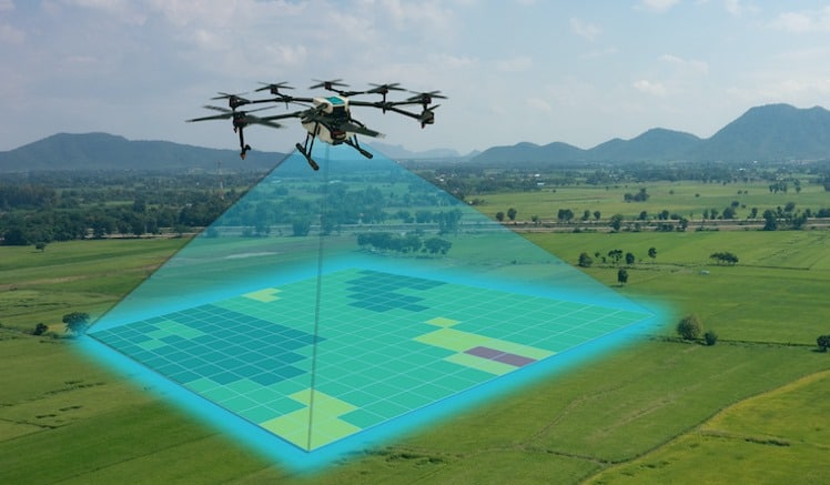

What Is a UAV/Drone Survey?
A UAV (drone) survey uses an unmanned aerial vehicle fitted with a high-resolution camera and GNSS positioning to capture data from above. Instead of walking the site point by point, the drone flies a planned pattern and captures hundreds of overlapping images, which our team processes into 2D and 3D deliverables: orthomosaics, digital elevation models, contour plans, and point clouds.
Every C&A drone flight is planned and flown in line with CASA’s national drone rules, and referenced to the Australian Height Datum (AHD) so it drops straight into your architect’s, engineer’s, or planner’s existing files.
600+ Reviews – Trusted on 100,000+ Projects
When Do You Need a UAV Survey in Canberra?
A drone survey earns its place on sites where a ground-based survey would take too long or can’t safely reach every corner:
Large or rural blocks: Covering several hectares from the air is faster and often cheaper than walking the whole site on foot.
Steep or inaccessible terrain: Drones capture data across slopes, dams, and gullies without anyone needing to physically get there.
Stockpile and excavation volumes: Regular flights track material movement and measure cut and fill volumes against your original plans.
Rooftop and tall structure capture: Get accurate rooftop measurements or inspect a tall structure without scaffolding or a lift.
Adjoining property context: Capture rooflines and site context from the air for shadow diagrams, without needing access to a neighbouring property.
DA submissions to the Territory Planning Authority: Aerial contour and site data supports your architect’s drawings wherever broad-area context strengthens the application.
If your site is large, steep, or hard to access on foot, a drone survey usually gets you better coverage in less time than a ground-based alternative.
600+ Reviews – Trusted on 100,000+ Projects

What’s Included in a C&A UAV Survey?
Here’s what happens from the moment you book to the moment your data lands in your inbox:
Free, no-obligation quote. Survey Express gets an expert surveyor on site within 72 hours of booking for most Canberra projects.
Flight planning. Our team checks Canberra’s airspace, including the exclusion zone around Canberra Airport and the restrictions near Parliament House and the Parliamentary Triangle, and plans the flight to stay compliant with CASA rules.
Data collection. The drone flies the planned pattern, capturing hundreds of overlapping high-resolution images and geo-coordinates.
Processing. Photogrammetry software turns the raw captures into orthomosaics, contour plans, digital elevation models, or point clouds.
Drafting and quality assurance. Every deliverable goes through our 3-step QA check before it’s finalised.
Delivery via C&A Connect. Track your job in real time and download your files the moment they’re ready, in the format your architect, engineer or planner already uses.
Every deliverable we hand over passes our 3-step QA process, so you can send it straight to your consultants with confidence.
Why Canberra Architects and Homeowners Choose C&A Surveyors
Here’s what backs every UAV survey we deliver in Canberra:
Full visibility, no radio silence. C&A Connect gives you real-time job tracking from booking through to delivery, so you always know where your survey stands.
The team behind the job. With 60+ staff and 25+ expert surveyors, C&A Surveyors has the depth to absorb delays and keep your job moving.
Fast turnaround. Survey Express gets an expert surveyor on site within 72 hours of booking for most Canberra projects.
Airspace know-how. Every flight is planned around Canberra’s restricted zones and flown in line with CASA rules, so you’re not left managing approvals yourself.
Transparent pricing. With our Price-Beat Guarantee, we’ll beat any like-for-like quote by 5% across many of the services we offer.
C&A Surveyors gives you the same surveying excellence from the 100,000+ projects we’ve completed since 2009.
600+ Reviews – Trusted on 100,000+ Projects

UAV Survey Canberra FAQs
How much does a UAV/drone survey cost in Canberra?
Cost depends on site size, terrain, and how much processing your deliverables need, so we don’t quote a flat figure. Every quote is upfront and transparent, and with our Price-Beat Guarantee we’ll beat any like-for-like quote by 5% across many of the services we offer.
What file formats will I receive, and will they work with my CAD or GIS software?
We deliver orthomosaics, contour plans, digital elevation models, and point cloud data in formats that work directly with common CAD, BIM, and GIS software. Flag your preferred format when you book if you need something specific.
Is a UAV survey suitable for a residential property, or only for large or rural sites?
It works for both, though it earns its keep most clearly on larger, sloping, or hard-to-access sites. For a standard suburban block, a ground-based detail or 3D survey is often the more practical choice. We can advise which fits your project when you book.
Can this survey be used for volumetric measurements like stockpile or excavation quantities?
Yes. Regular drone flights track material movement over time and measure cut and fill volumes against your original plans, useful for monitoring earthworks or stockpile levels through a project.
Can this survey be used to support a DA with the Territory Planning Authority?
Yes. Aerial contour and site data gives your architect broader site context to prepare DA drawings, and the Territory Planning Authority assesses your application against the Territory Plan using that same information.
Get Your Canberra UAV Survey Started
Our UAV survey gets you aerial coverage, contours, and volumetric data across a Canberra site that would take far longer to capture on foot, all in accordance with CASA rules.
Ready to work with a Canberra surveyor who keeps you in the loop from booking to delivery? Get a free quote today, or call our team to get Survey Express started within 72 hours.
"*" indicates required fields
Why Choose C&A Surveyors?
Survey Experts – Over 100,000 successful projects
Fastest Turnaround – On-site within 48 hours
C&A Connect Portal – Live tracking, job updates & direct communication
Court-Ready Reports – Legal documentation for disputes or approvals
Don’t risk costly mistakes. Get your property boundaries surveyed by the experts today.
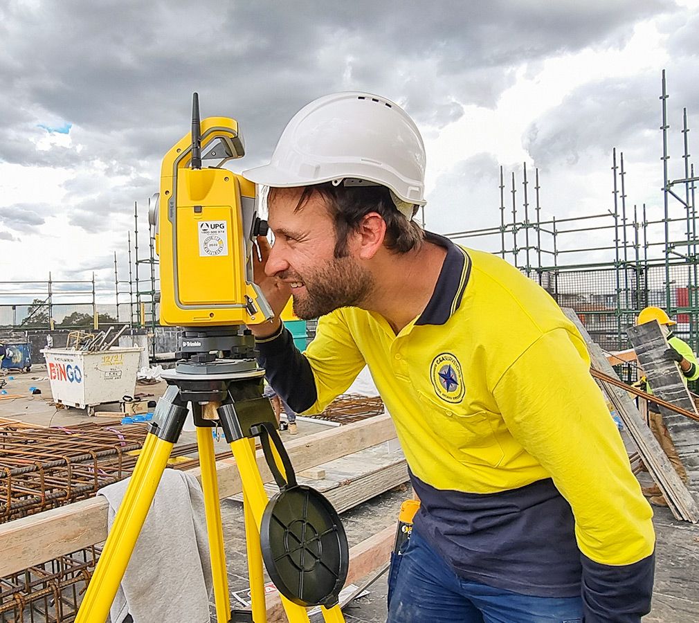
Canberra’s Trusted Surveyors
Trusted by homeowners, architects, builders and developers: our clients consistently rate us five stars for precision, speed and service.




Built on trust. Driven by precision. Focused on your success.
Surveying doesn’t have to be complicated. We make it seamless, collaborative and backed by people who care.