Table of Contents
Land surveyors perform a range of land surveys depending on the property or the construction project. They use the latest technology and calculation methods to provide you with the most accurate survey results.
Below, we outline six different types of land surveys. We also cover when to use them for residential properties or construction projects.
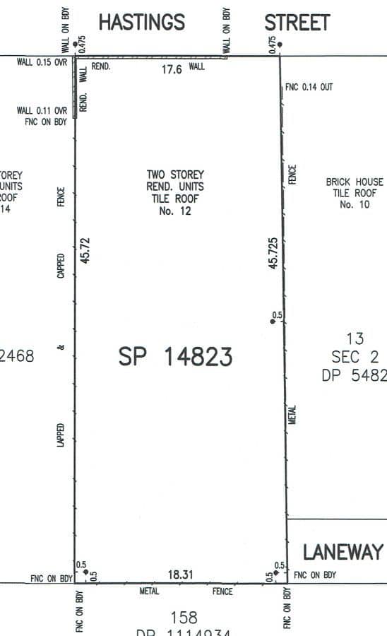
Boundary Survey
Land surveyors conduct boundary surveys to determine the correct property lines for a plot of land. This involves:
- Researching the property’s Deposited Plan and Certificate of Title
- Reviewing historic survey data and adjoining parcels
- Physically attending the site and locating boundaries using specialised survey equipment
- Marking the property boundary lines on the ground
When is it needed?
- Installing new fences or retaining walls
- Resolving boundary disputes
- At times, when lodging Development Applications (DAs) or applying for Development Consent
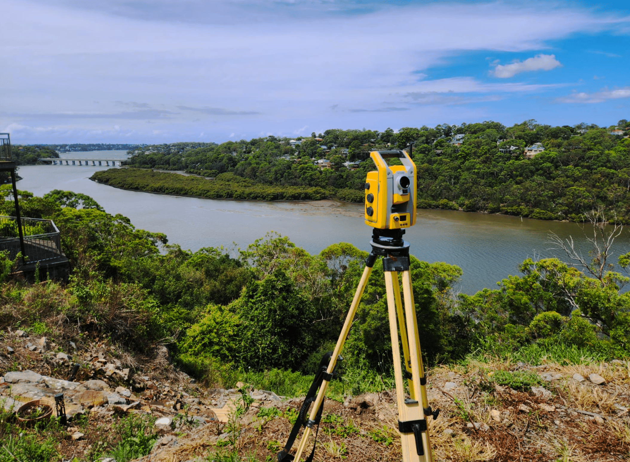
Topographic Survey
A topographic survey maps the features and levels of the land, identifying both natural and man-made elements, such as:
- Buildings and structures
- Existing easements and infrastructure
- Trees, fences, and retaining walls
- Driveways, street kerbs, and service pits
- Site levels and contours
Surveyors use advanced equipment and CAD (Computer-Aided Design) software to generate accurate site plans — and even 3D models if required.
When is it needed?
- To help architects and engineers plan around site conditions
- Before designing a new home or extension
Identification Survey and Report
An Identification Survey and Report shows where structures sit in relation to property boundaries — and whether any encroachments exist.
This includes:
- A site inspection and calculations
- A sketch prepared using CAD
- A written report signed by a Registered Surveyor
When is it needed?
- As part of a Contract of Sale (requested by solicitors and conveyancers)
- When Council suspects unauthorised works
- At the end of construction to confirm the building is within the approved footprint
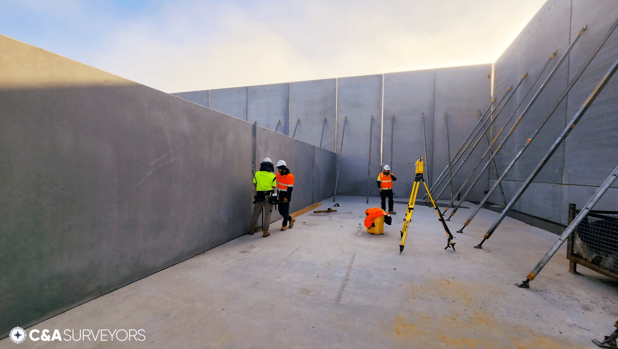
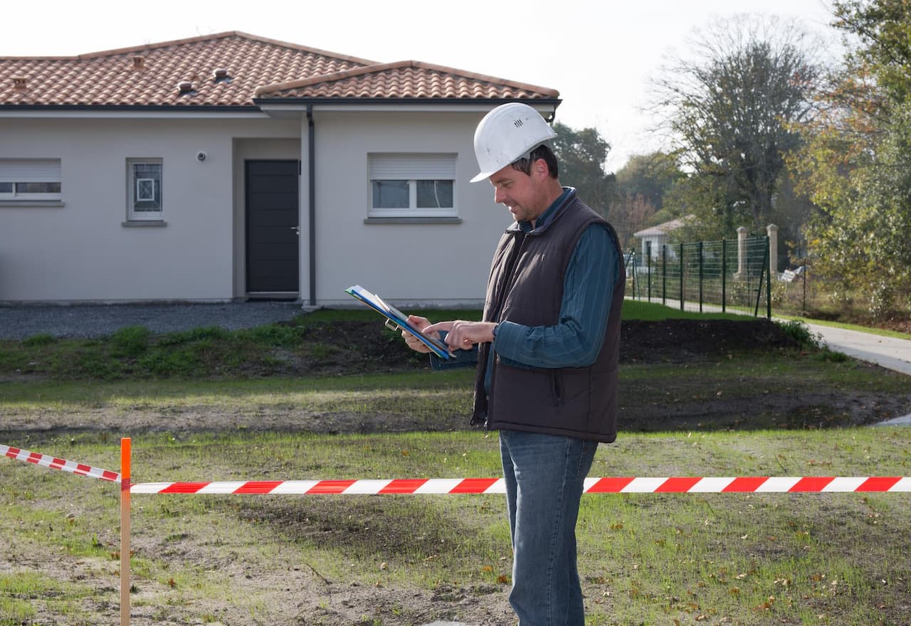
Construction Survey
Land surveyors use the approved architectural plans as well as Deposited Plans to determine the approved proposed location of a new structure.Using the approved plans, surveyors:
- Provide a set-out sketch signed by a Registered Surveyor
- Place physical marks on-site for builders, bricklayers, concreters and other trades to follow
When is it needed?
- For accurate placement of foundations, walls, and service lines
- To maintain compliance with DA approvals and avoid rework
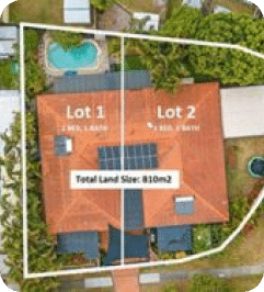
Subdivision Survey
Any property owner or developer needs a subdivision survey if they want to divide their land.
A subdivision survey legally divides a property into two or more lots. This involves:
- Preparing a Preliminary Plan for Council or Certifier approval
- Creating a Final Plan of Subdivision for registration with NSW Land Registry Services
When is it needed?
- Subdividing land for dual occupancies, townhouses, or separate titles
- Creating strata or community title schemes

Easement Survey
A land surveyor:
- Reviews the hydraulic engineer’s stormwater design
- Determines the correct method for easement registration (via Transfer or Section 88B Instrument)
- Prepares an Easement Plan and coordinates with your legal team
When is it needed?
- To run stormwater pipes through neighbouring land
- When Council or a Certifier requires drainage rights as part of development approval
Final Thoughts: Why Quality Land Surveys Matter
Whether you’re preparing to build, renovate, sell, or subdivide — a professional land survey provides more than just lines on a map. It delivers confidence, compliance, and clarity. In today’s tightly regulated and highly competitive property landscape, a well-executed land survey is one of the smartest investments you can make.
Each type of survey serves a distinct purpose:
- Boundary Surveys protect you from disputes and costly legal headaches.
- Topographic Surveys help architects design smarter and more efficiently.
- Identification Surveys ensure structures are built in the right place — and stay compliant.
- Construction Surveys guide trades on-site to build with precision.
- Subdivision Surveys unlock value by legally creating new lots.
- Easement Surveys ensure essential services like drainage are secured and documented.
Yet beyond the technicalities, a land survey is your assurance that what’s on paper matches what’s on the ground — reducing risk and keeping your project on track.
At C&A Surveyors, we understand that each client has different goals, timelines, and challenges. That’s why we don’t just deliver surveys — we provide support throughout the journey.
- 🧑💼 Conveyancers and solicitors turn to us for clear, compliant plans that stand up in contracts and councils.
- 🧭 Homeowners gain peace of mind when building a fence, selling, or starting a renovation.
- 🏗️ Builders and developers rely on fast, precise data to avoid project delays.
- 🧱 Architects and designers use our surveys to design with confidence and accuracy.
To learn more about how we help guide you through the survey process, check out our video below:
Why C&A Surveyors? How We Can Help You.
Not all surveys are created equal — accuracy, turnaround time, and clear communication make all the difference.
At C&A Surveyors, we’re proud to be one of Sydney’s most trusted survey firms. Our reputation is built on precision, speed, and reliability.
Here’s what you can expect:
- ⭐ 4.9-star Google rating from over 200 satisfied clients
- 👷♂️ Dedicated project manager from start to finish
- 📐 Accurate, compliant survey plans
- 🏗️ Preferred by architects, builders, and private clients across NSW
- 💼 Fully insured and registered with the NSW Board of Surveying and Spatial Information (BOSSI)
Whether you’re a homeowner, architect, developer, or builder, we’ll make the surveying process smooth and hassle-free.