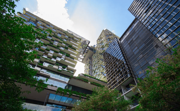
From preserving historical treasures to streamlining the construction of Sydney’s latest skyscraper, 3D laser scanning is revolutionising how we visualise and document the physical world. This advanced technology creates digital replicas of real-world spaces with remarkable precision, transforming how architects, engineers, builders, land surveyors and facility managers approach their work.
In this comprehensive guide, we’ll explore what 3D laser scanning is, how it works, its history and origins, current applications, pros and cons compared to traditional surveying, common mistakes to avoid, and exciting future trends.
- What is 3D Laser Scanning?
- History and Origins of 3D Laser Scanning
- How Does The 3D Laser Scanning Process Work?
- Key Benefits of 3D Laser Scanning
- Common Applications of 3D Laser Scanning
- Case Studies and Real-World Examples
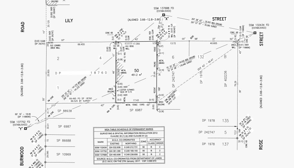
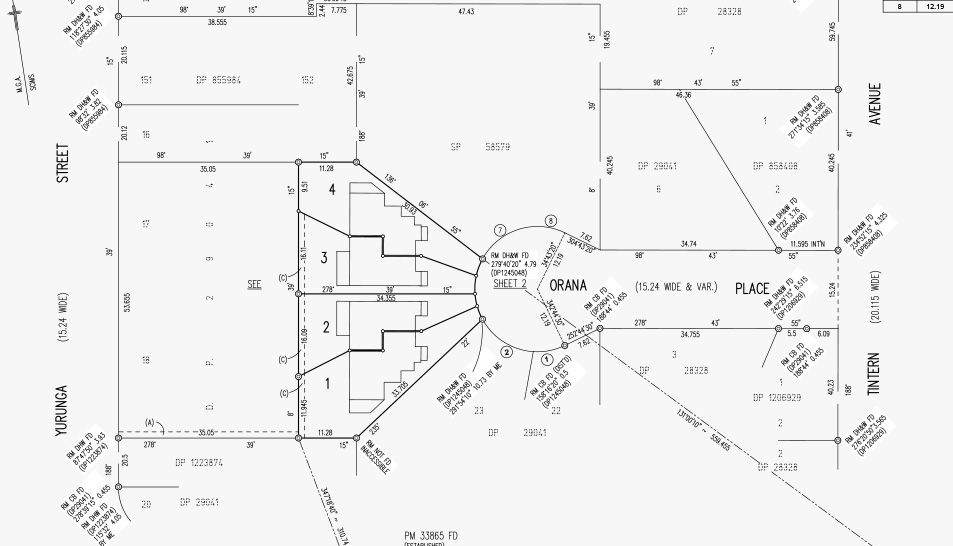
- Deliverables Produced by 3D Laser Scanning
- Pros and Cons: 3D Laser Scanning vs Traditional 2D Surveying
- Common Mistakes to Avoid with 3D Laser Scanning
- The Future of 3D Laser Scanning: Emerging Trends
- Choosing the Right Scanning Solution
- Expert Insight
- Frequently Asked Questions (FAQs)
What is 3D Laser Scanning?
3D laser scanning is a powerful technology that uses LiDAR (Light Detection and Ranging) to capture precise spatial measurements of buildings, structures, landscapes, and objects, to produce detailed and accurate digital representations called point clouds.
A laser scanner emits millions of laser pulses that reflect off surfaces and return to the sensor. By calculating the time it takes for each pulse to return, the scanner precisely measures distances, creating a detailed 3D digital representation of the scanned area known as a “point cloud.” Each point in the cloud contains x, y, and z coordinates, capturing every dimension of an environment with remarkable accuracy (within millimetres).
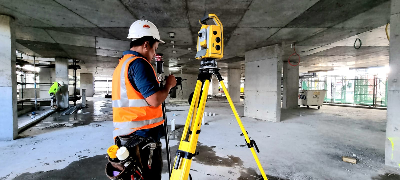
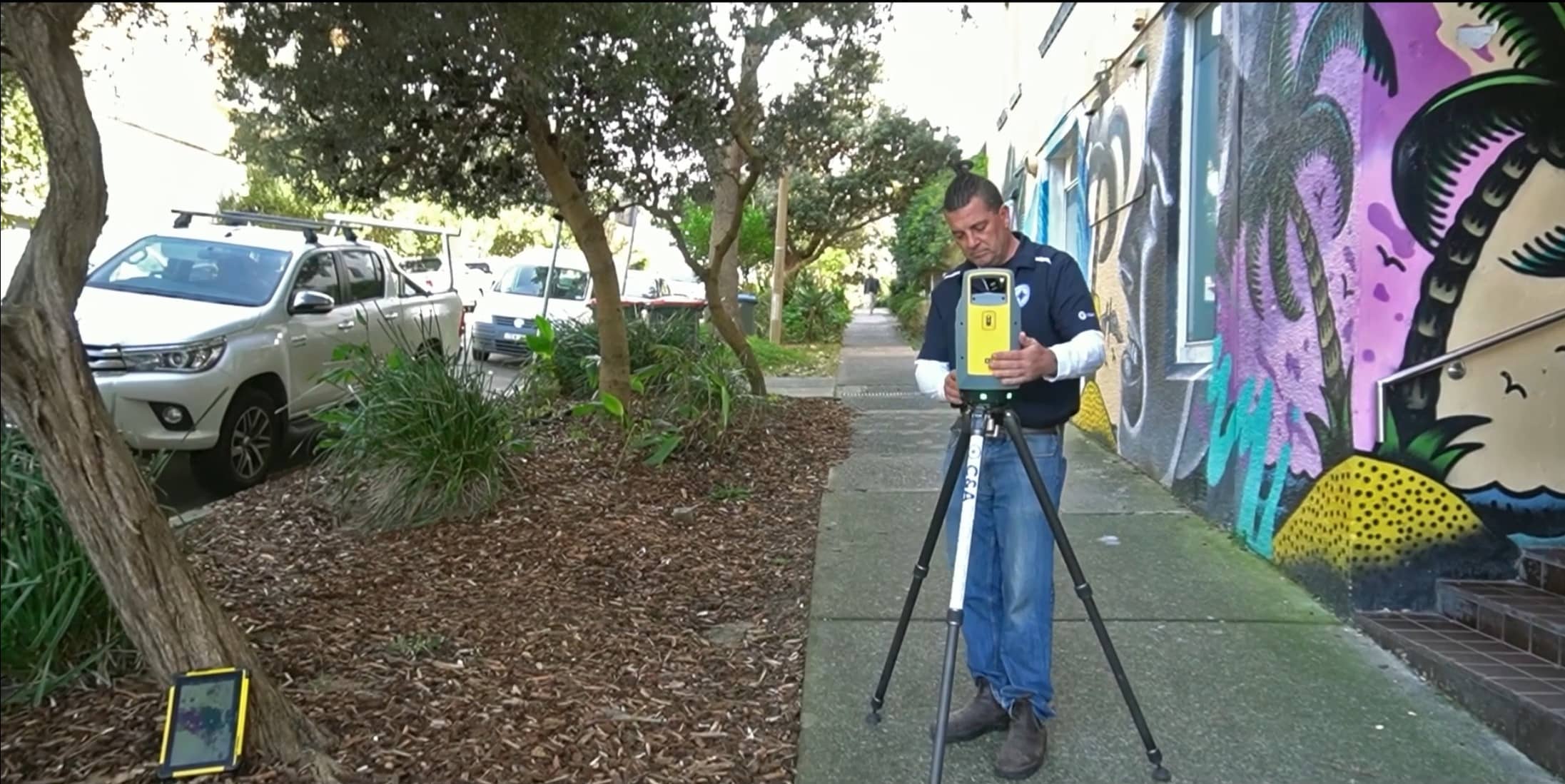
Modern scanners, such as the Leica RTC360 or FARO Focus, can capture millions of points per second, quickly building comprehensive 3D models. The scanning process typically involves positioning the scanner at multiple locations around a site to ensure complete coverage, overcoming line-of-sight limitations.
History and Origins of 3D Laser Scanning
3D laser scanning, now a staple technology across construction, engineering, and architecture, has a rich history that spans over five decades. Here’s a comprehensive timeline outlining the evolution of this transformative technology:
Early Beginnings (1960s–1970s)
- 1960: The birth of LiDAR technology originated shortly after the invention of the laser itself. Initially, it was primarily employed by NASA and military organisations for remote sensing, mapping terrains, and topographical analysis.
- 1971: NASA famously utilised early LiDAR scanners during the Apollo 15 mission to map the Moon’s surface with unprecedented detail.
Technological Advancement and Commercialisation (1980s–1990s)
- 1980s: Development of more compact, accurate, and cost-effective laser scanning systems began. The technology gained broader acceptance for use in aerial surveying and geographic information systems (GIS).
- 1990s: Significant advancements in computing technology allowed 3D scanning to transition from strictly aerial applications to terrestrial (ground-based) scanning, opening up applications in construction and heritage preservation. Notably, companies such as Cyra Technologies (later acquired by Leica Geosystems) pioneered the first commercial terrestrial 3D scanners.
Rapid Commercial Growth (2000s)
- Early 2000s: Terrestrial laser scanners became more accessible, affordable, and accurate, leading to widespread adoption. Major surveying technology providers, like Leica, Faro, and Trimble, launched sophisticated terrestrial scanners that offered millimetre-level accuracy and drastically improved speed of data capture.
- Mid-2000s: Integration of laser scanning with Building Information Modelling (BIM) transformed the architectural, engineering, and construction (AEC) industries, allowing for precise digital modelling and improved construction workflows.
Modern Era (2010–Today)
- 2010 onwards: Advancements such as mobile LiDAR, drone-based scanning, and handheld scanning solutions emerged, providing rapid, efficient, and portable methods for capturing highly accurate data.
- Present: Today’s state-of-the-art scanners like the Leica RTC360 and Faro Focus offer real-time data processing, sub-centimetre precision, integrated HD photography, and cloud-based collaboration, making 3D laser scanning an indispensable tool in countless industries.
How Does The 3D Laser Scanning Process Work?
The scanning process involves five main steps:
- Project Planning: Clearly define objectives, deliverables, scan resolution, and accuracy.
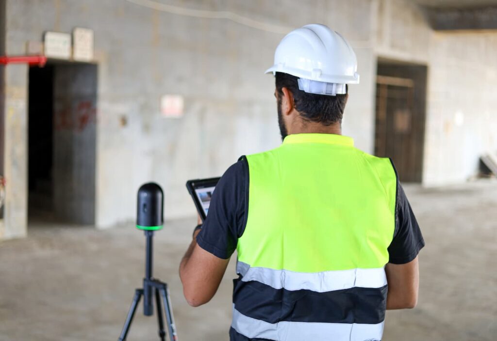
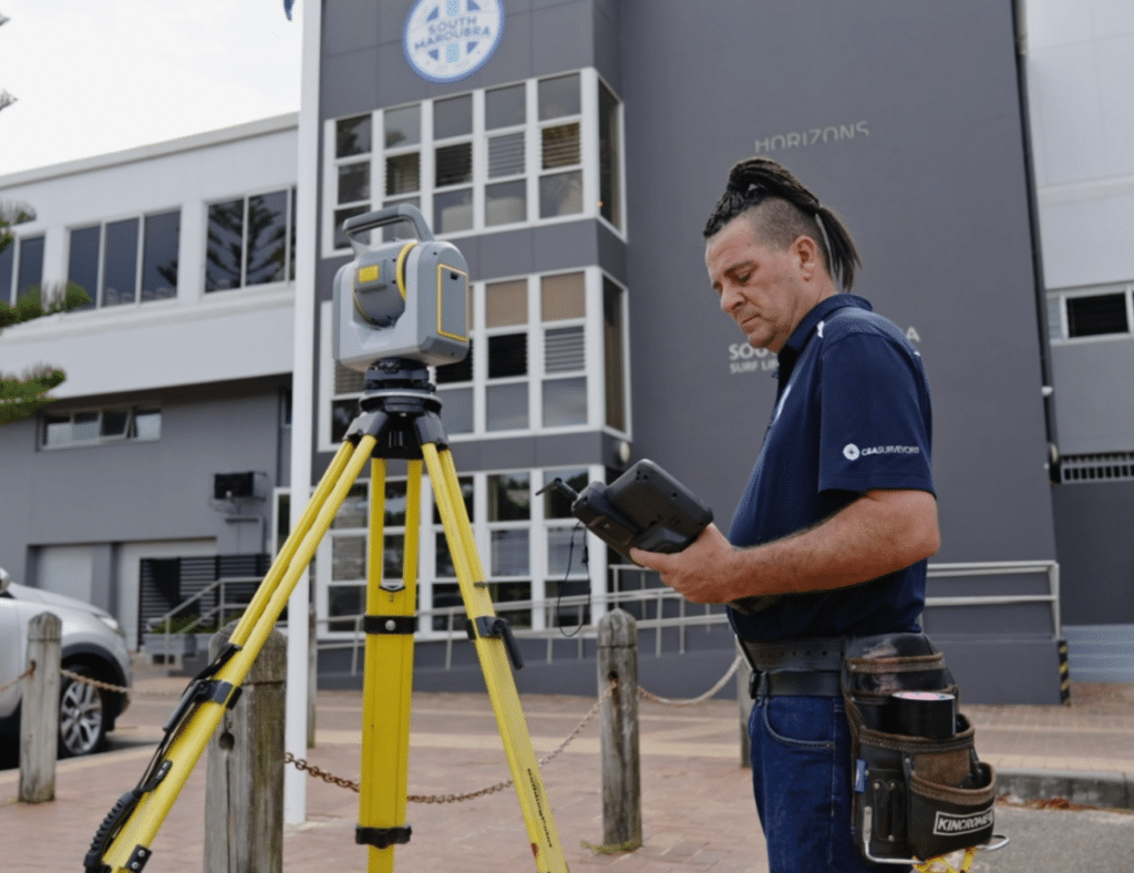
- On-site Scanning: Trained technicians position the scanner at strategic points, capturing millions of spatial data points via laser pulses.
- Data Capture: Laser pulses reflect off surfaces, calculating exact coordinates (x, y, z).
- Data Processing: Individual scans from multiple locations are combined into a unified point cloud.
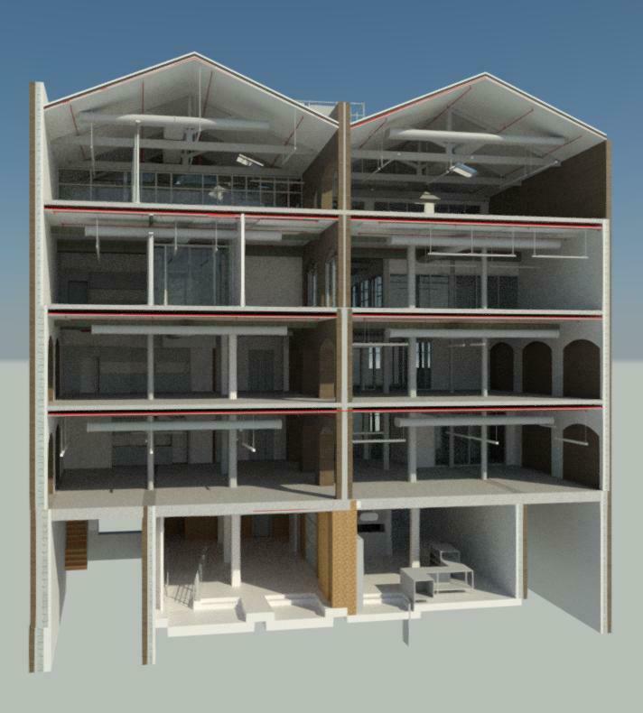
- Modelling Data into Interactive Deliverables: Our experienced in-house team of modellers convert the registered point cloud into practical user-friendly formats and models that are intuitive and accessible for architects, engineers, contractors and facility managers, to facilitate informed decision-making throughout the project lifecycle
- Quality Assurance and Legal Verification: If project scope includes boundary identification, a Registered Surveyor reviews the completed models to verify that all property boundaries and relevant survey information have been accurately represented. Once verified, the Registered Surveyor provides formal approval and signs off on the documentation, transforming it into a legally recognised and authoritative survey report.

Key Benefits of 3D Laser Scanning
- High Accuracy: Captures precise details with millimetre-level accuracy.
- Efficiency: Reduces traditional survey times significantly.
- Detailed Documentation: Provides thorough, measurable, and verifiable records.
- Cost Savings: Minimises errors, rework, and additional site visits.
- Safety and Accessibility: Safely documents hazardous or hard-to-reach areas.
Common Applications of 3D Laser Scanning
1. Architecture and Construction
Architects and builders use 3D laser scanning to capture existing site conditions accurately. This precise data helps produce accurate as-built drawings, facilitate building information modelling (BIM), and support prefabrication processes, ultimately saving time and resources.
2. Engineering Projects
Engineers rely on 3D scans for precise measurements critical in structural analysis, design validation, and project planning. Accurate scans help identify potential issues early, enabling efficient clash detection and avoiding costly redesigns.
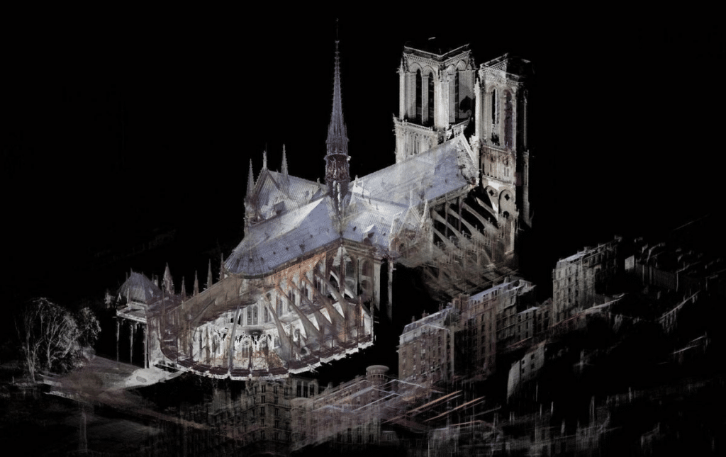
3. Historical Preservation
Laser scanning plays a crucial role in heritage preservation, allowing detailed documentation of historical sites without causing damage. High-resolution point clouds help conservationists restore and maintain architectural details accurately, such as intricate façades or ancient structures.
4. Facility and Asset Management
Facility managers use 3D scans to create comprehensive digital twins of buildings and industrial facilities. These digital twins allow for improved asset management, facility maintenance planning, and informed decision-making based on precise visual data.
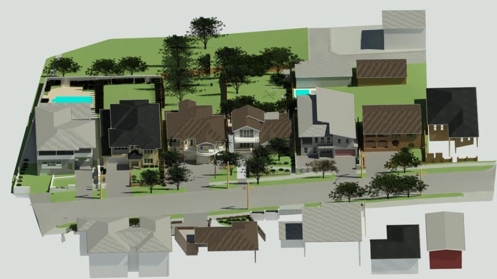
5. Infrastructure and Urban Planning
Scanning aids infrastructure projects by accurately mapping roads, bridges, and public utilities, enhancing safety and efficiency. Urban planners benefit by visualising proposed developments within existing environments through detailed 3D scans, improving stakeholder communication and approvals.
6. Forensic Investigation
Law enforcement and forensic teams utilise laser scanning to accurately document crime and accident scenes. The detailed scans preserve vital evidence for analysis and courtroom presentations, providing clarity and objectivity in investigations.
Case Studies and Real-World Examples
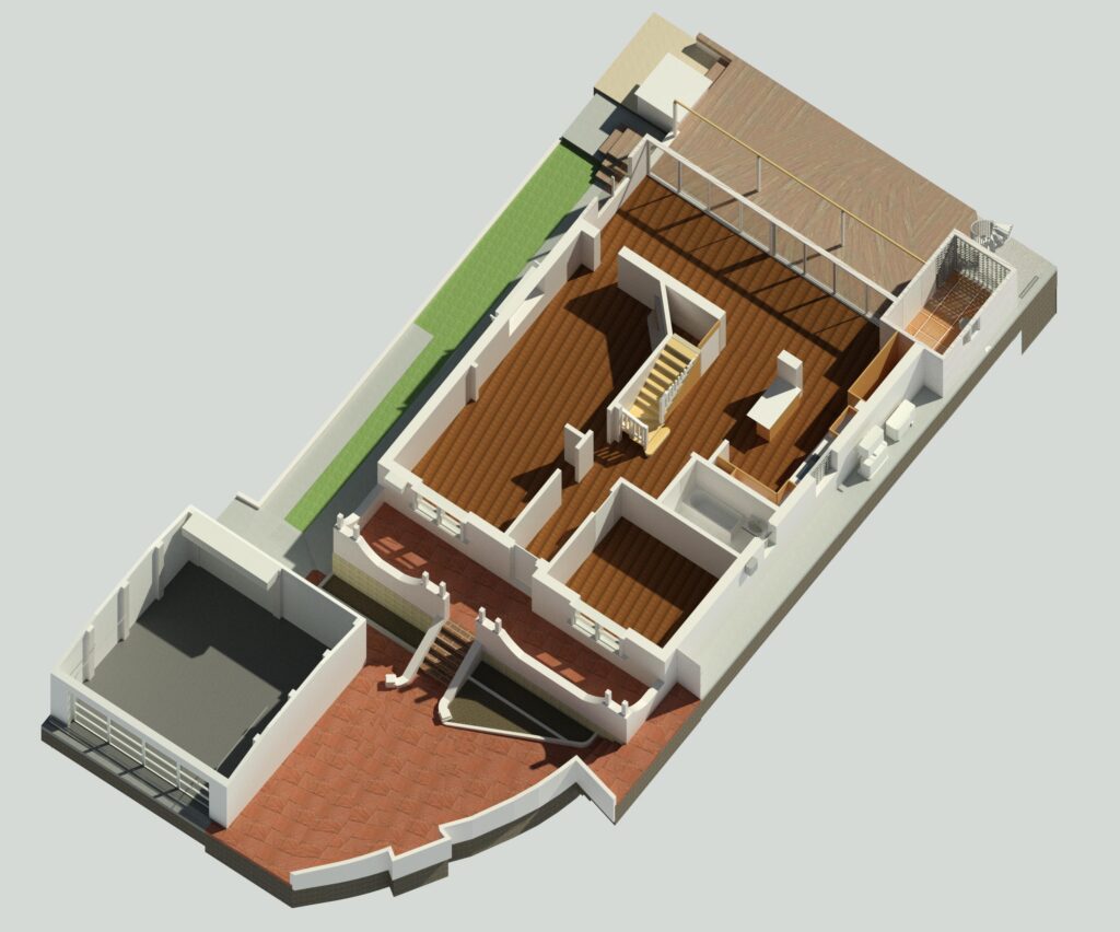
- Residential Renovation, Vaucluse (Sydney, NSW): A detailed laser scan of an existing heritage-listed home allowed architects to develop precise renovation plans, preserving original architectural elements while seamlessly integrating modern features.
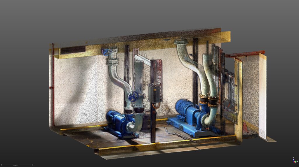
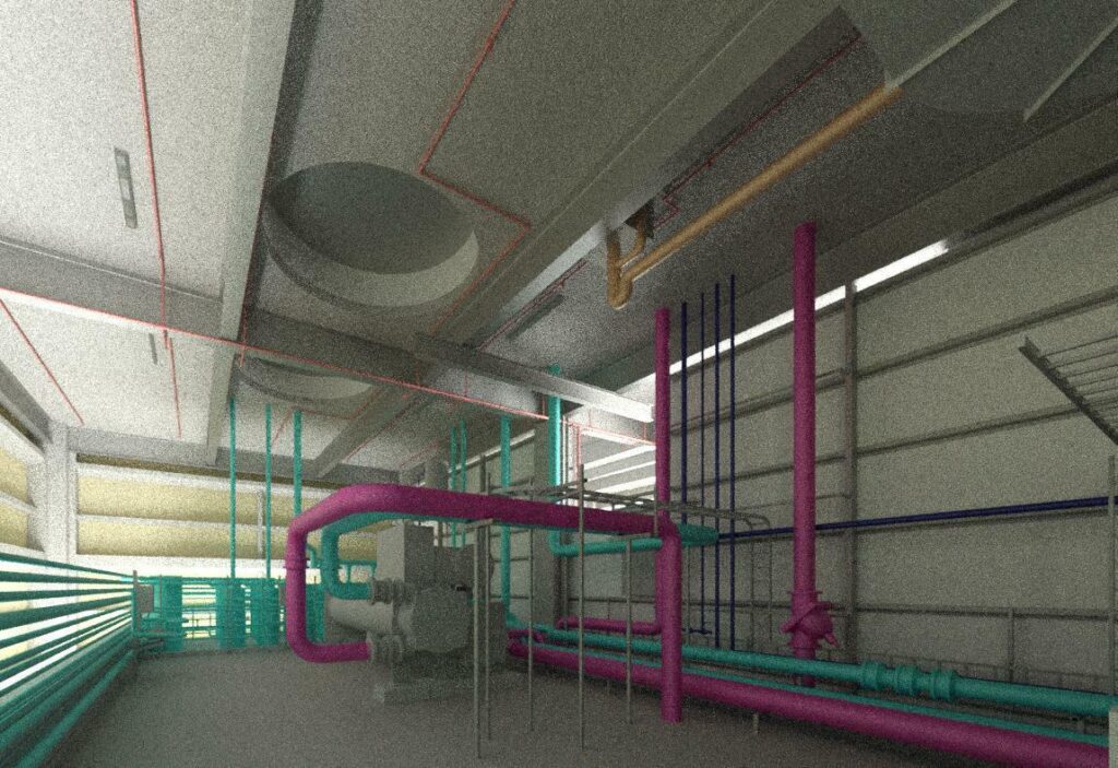
- Commercial Development, Footscray (Melbourne, Victoria): Laser scanning facilitated accurate modelling of complex mechanical, electrical, and plumbing (MEP) systems, reducing project timelines and preventing costly onsite errors.
- Infrastructure Project, Hendra (Brisbane, Queensland): Detailed scanning of a bridge provided engineers with accurate structural data, significantly improving project safety and efficiency during renovations.
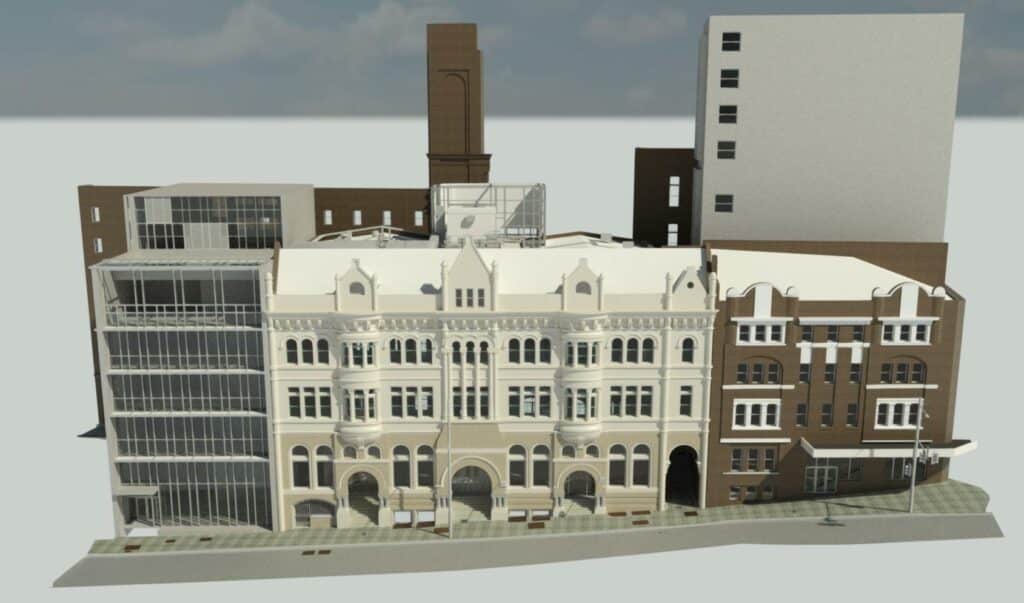
Deliverables Produced by 3D Laser Scanning
- Point Clouds: Raw data representing millions of measurement points.
- 3D Models: Detailed digital models for BIM, CAD, and virtual walkthroughs.
- Virtual Tours and Walkthroughs: Interactive digital experiences for client and stakeholder presentations.
- Digital Twins: Comprehensive, virtual replicas of physical assets or environments.
Pros and Cons: 3D Laser Scanning vs Traditional 2D Surveying
| Feature | 3D Laser Scanning | Traditional 2D Surveying |
| Speed | Rapid data capture (millions of points/second) | Slow, manual point-by-point measurements |
| Data Richness | Comprehensive 3D data | Limited 2D coordinates |
| Versatility | Creates multiple deliverables | Limited deliverable options |
| Cost | Higher upfront but lowers total project cost | Lower upfront cost |
| Complexity | Requires specialised training | Requires specialised training |
Conclusion: 3D scanning excels in accuracy, speed, and versatility, making it invaluable for complex or detailed projects despite higher initial investments.
Common Mistakes to Avoid with 3D Laser Scanning
To ensure a successful scan, avoid these pitfalls:
- Poor Scope Definition: Unclear goals can lead to unnecessary costs and data overload. Clearly define required outputs (e.g., 2D drawings vs detailed 3D models).
- Limited Site Access: Restricted access means missed areas or incomplete data. Plan site access thoroughly with your surveyor.
- Insufficient Scan Stations: Too few scan positions can leave data gaps. Trust an experienced technician’s recommendation on required positions.
- Ignoring Scan Resolution Needs: A low-resolution scan or poor equipment won’t capture critical details for historical preservation, while high-resolution scans may be excessive for simple layouts.
- Choosing Inexperienced Providers: Accurate scanning requires trained technicians and reputable equipment; choose wisely to avoid costly reworks.
The Future of 3D Laser Scanning: Emerging Trends
As scanning technology evolves, expect significant developments:
- Artificial Intelligence (AI) Integration: AI-driven scanners will automatically identify and classify objects, increasing speed and accuracy in complex environments.
- Real-Time Reality Capture: Future scanners will deliver instant point clouds and model updates, ideal for live construction monitoring.
- Wearable & Mobile Scanners: Compact, wearable devices will enable continuous scanning while technicians walk the site, enhancing productivity.
- Cloud-Based Processing: Faster, accessible processing on cloud platforms, enabling collaborative remote viewing and analysis.
As these innovations unfold, expect laser scanning to become even faster, more accessible, and integral to all stages of design, construction, and maintenance.
Choosing the Right Scanning Solution
Selecting the right laser scanning solution involves considering the project requirements such as resolution, accuracy, project scale, and deliverable needs. Consulting with experienced scanning providers ensures optimal outcomes, efficient workflows, and valuable insights into using laser scanning effectively.
Expert Insight
“The pace of advancement in 3D laser scanning is unprecedented. Soon, we’ll see scanners everywhere – not just on tripods, but built into everyday devices – turning every walk-through into valuable digital data.”
— Tristan Smythe, 3D Modelling Manager, C&A Surveyors
Frequently Asked Questions (FAQs)
How long does a 3D laser scan take?
Most residential or commercial scans take several hours to a few days, depending on the size and complexity of the project.
Is 3D laser scanning safe?
Yes, laser scanning is entirely safe. It uses Class 1 lasers, posing no risk to humans, animals, or structures.
Can 3D scans replace traditional surveys?
Yes, 3D laser scanning excels in detailed data capture and the data can be used in line with traditional surveys. Some councils require surveys that have the boundaries of your property defined, so it’s important you consult with us prior to booking in a survey.
Will 3D laser scanning disrupt my site?
No. Laser scanning is non-invasive, silent, and safe for people, animals, and structures. Scans are typically completed with minimal disturbance.